Main Presentations (scroll down for graphics):
Graphics and animations in this talk are linked by section below.
Permission is granted for news media use of all graphics, with attribution to "Southern California Earthquake Center, USC"
- Expansion of the Southern California Seismic Network (SCSN)
- Development of the Community Fault Model (CFM)
- Deployment of the Southern California Integrated GPS Network (SCIGN)
- Development of the Uniform California Earthquake Rupture Forecast (UCERF)
- Improvement of Probabilistic Seismic Hazard Analysis (PSHA)
- Development of simulation-based ground-motion prediction models (CyberShake)
- Scientific support of the ShakeOut Earthquake Preparedness Drills
Additional Resources and Events:
- 30-second interviews of people sharing their experience of the Northridge Earthquake (email benthien@usc.edu if you would like to interview any of our interviewees)
- 16 animations of Northridge-sized earthquakes that can occur on faults throughout Southern California
- Northridge anniversary events (presentations, conferences, meetings, etc.)
1. Expansion of the Southern California Seismic Network (SCSN)
Seismic Stations in 1993. Small Dots: Older Analog Stations. Triangles: Advanced Digital Stations
Seismic Stations in 2013. Small Dots: Older Analog Stations. Triangles: Advanced Digital Stations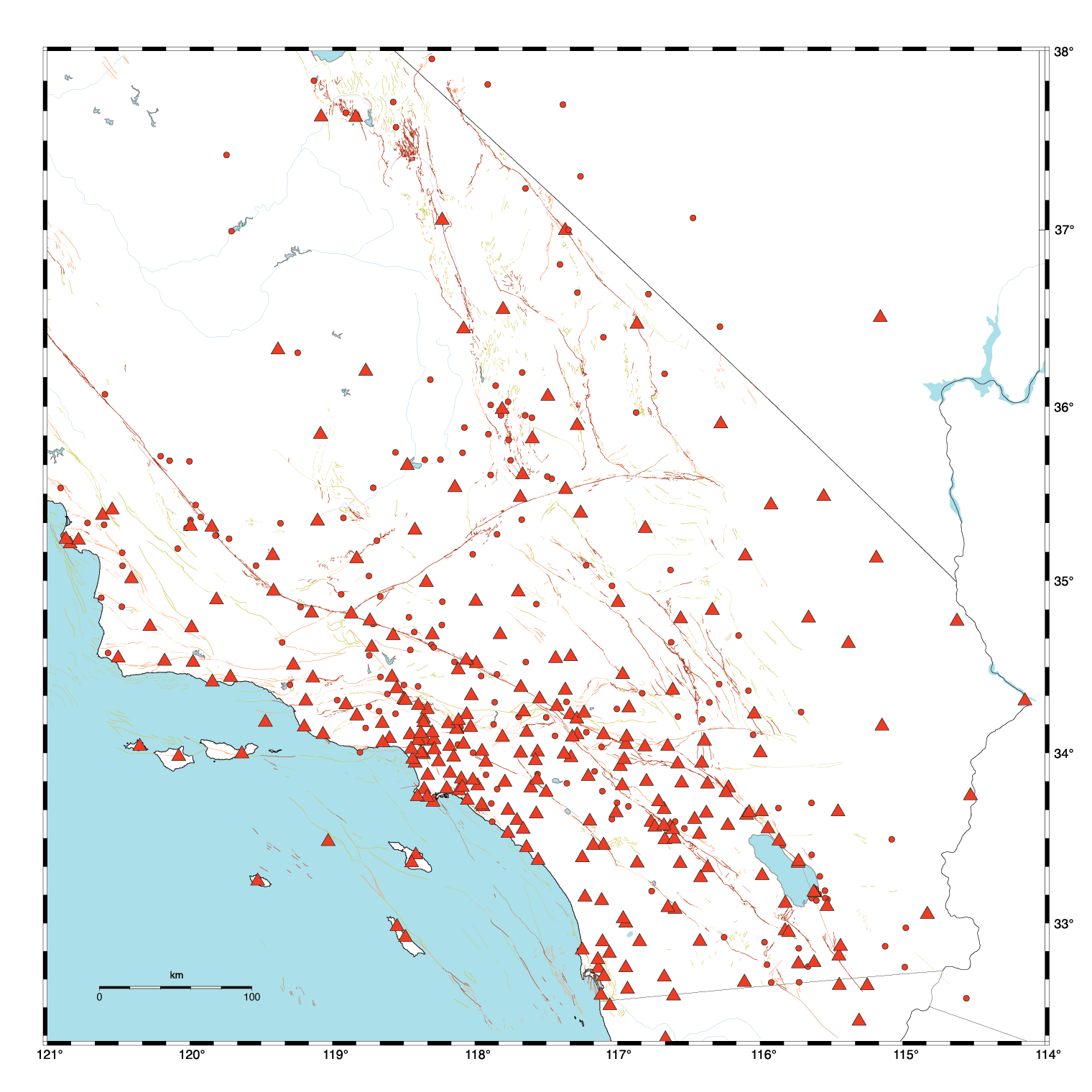
Earthquakes in Southern California 1981-1993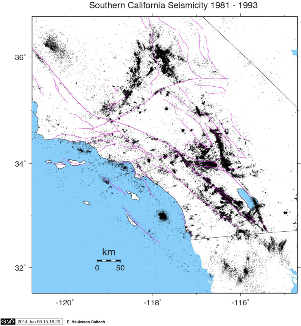
Earthquakes in Southern California 1994-2013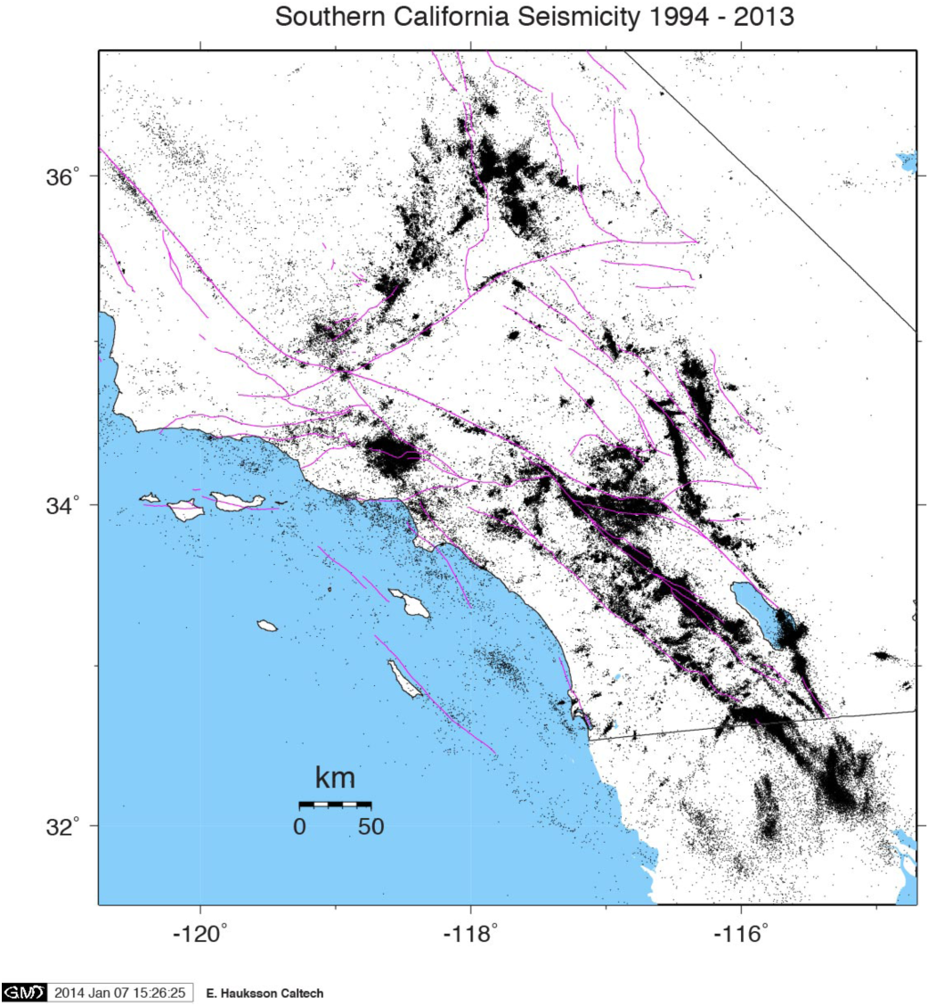
Earthquakes in Southern California 1994-2013 (Black dots are more precisely mapped (relocated) earthquakes because of advancements in understanding of how fast seismic waves travel through the subsurface structures of Southern California. Green dots are earthquakes that have not been relocated.)

2. Development of the Community Fault Model (CFM)
1996 National Seismic Hazards Map faults in Southern California (including recently recognized blind thrust fault of the Northridge earthquake (yellow)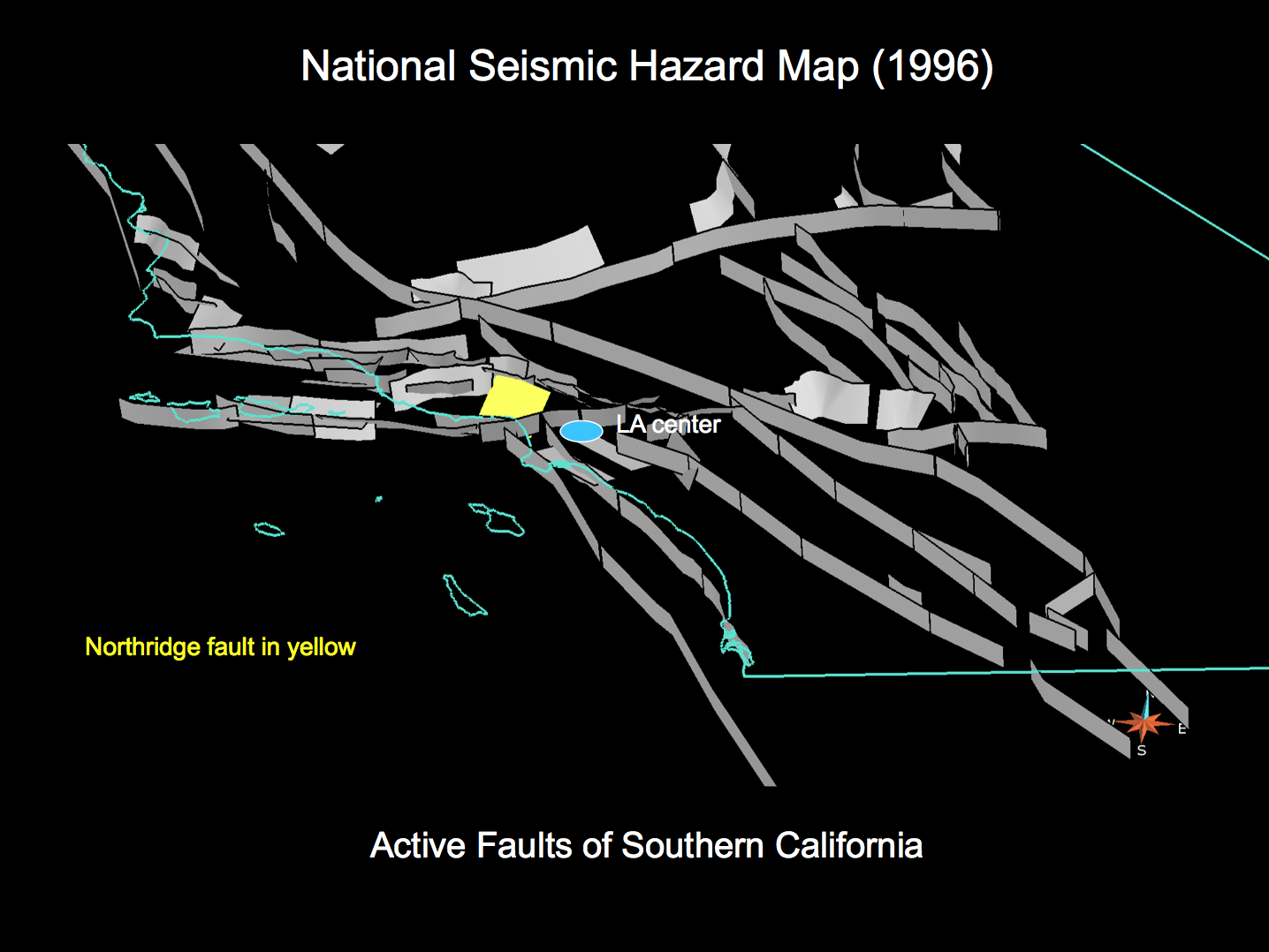
1996 National Seismic Hazards Map faults in Southern California (including recently recognized blind thrust fault of the Northridge earthquake (yellow) and other known blind thrust faults at the time.
2013 SCEC Community Fault Model showing newly mapped blind thrust faults (red) and the Northridge fault (yellow) (Provided by Plesch et al. (personal communication, 2014)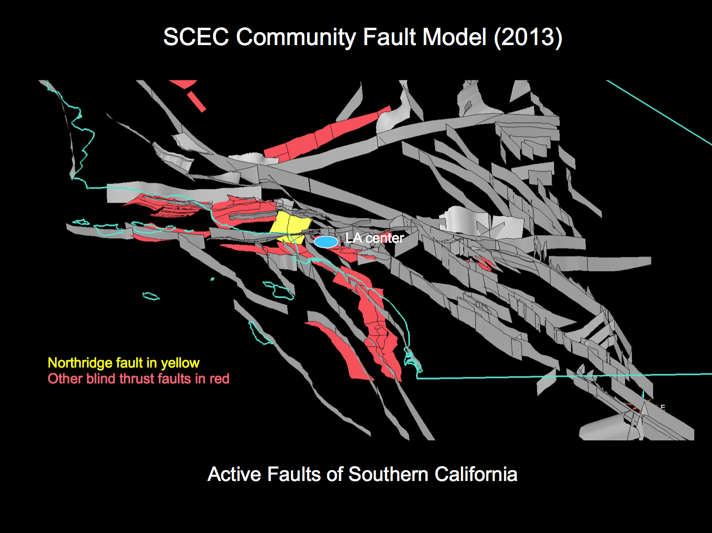
Zoomed in view (Los Angeles area, looking north) of 1996 National Seismic Hazards Map faults in Southern California (including recently recognized blind thrust fault of the Northridge earthquake (yellow)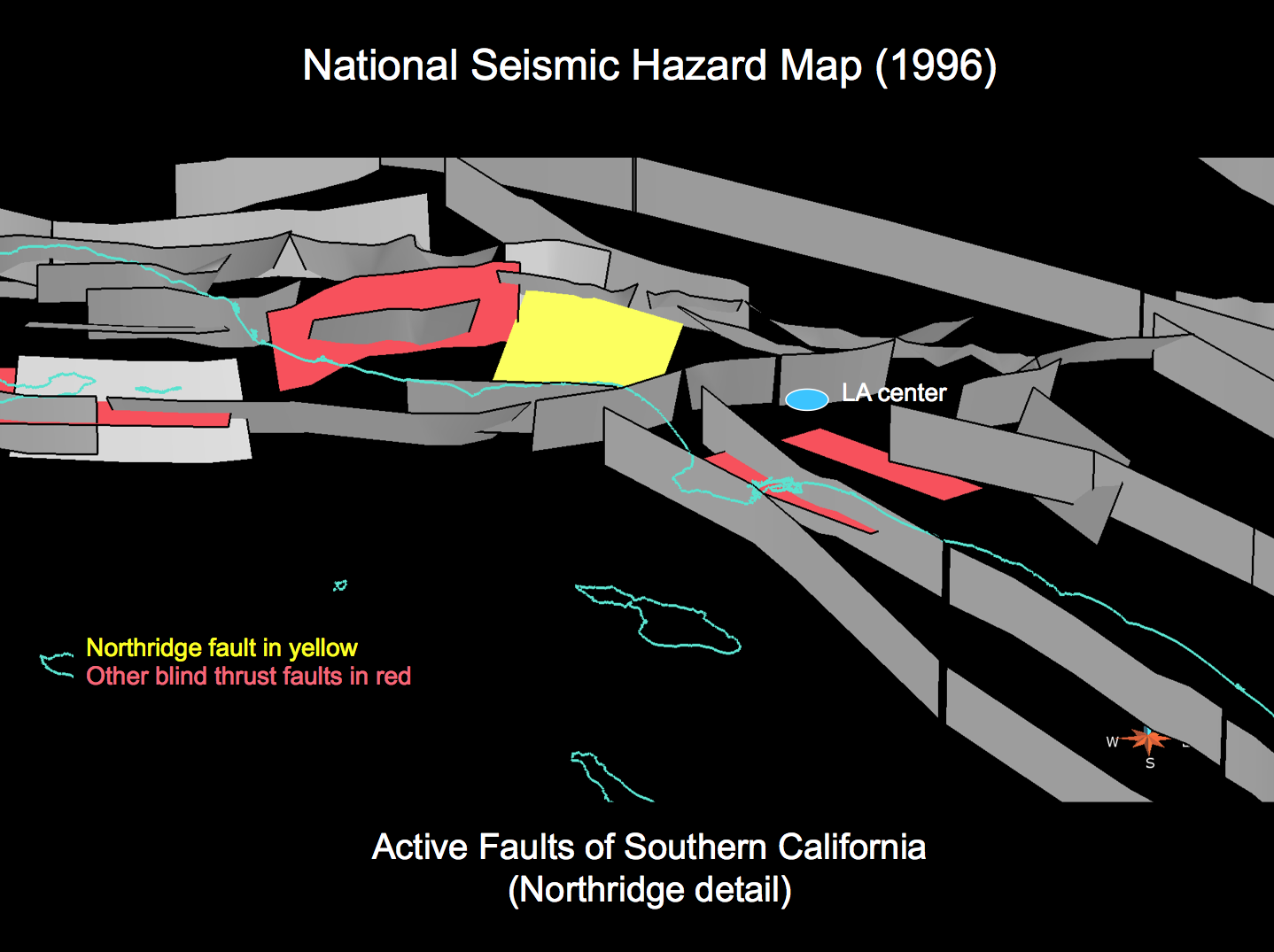
Zoomed in view (Los Angeles area, looking north) of 2013 SCEC Community Fault Model showing newly mapped blind thrust faults (red) and the Northridge fault (yellow) (Provided by Plesch et al. (personal communication, 2014)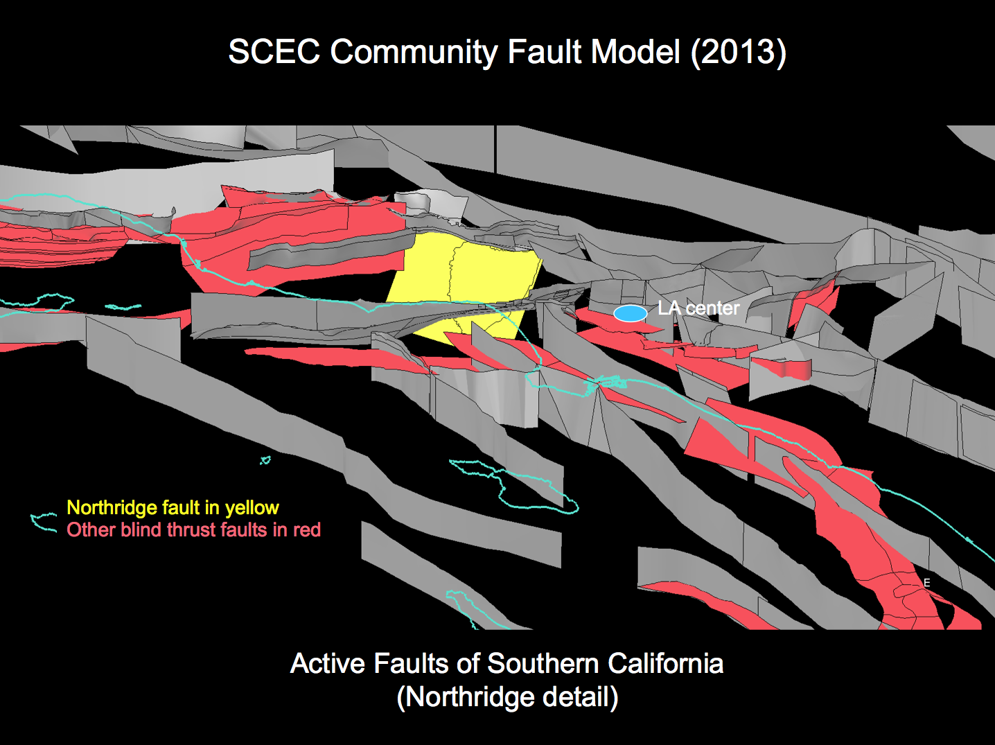
Zoomed in view (Los Angeles area, looking northwest) of 1996 National Seismic Hazards Map faults in Southern California (including recently recognized blind thrust fault of the Northridge earthquake (yellow)
Zoomed in view (Los Angeles area, looking northwest) of 2013 SCEC Community Fault Model showing newly mapped blind thrust faults (red) and the Northridge fault (yellow) (Provided by Plesch et al. (personal communication, 2014)
Zoomed in view (Ventura area, looking west) of 1996 National Seismic Hazards Map faults in Southern California (including recently recognized blind thrust fault of the Northridge earthquake (yellow)
Zoomed in view (Ventura area, looking west) of 2013 SCEC Community Fault Model showing newly mapped blind thrust faults (red) and the Northridge fault (yellow) (Provided by Plesch et al. (personal communication, 2014)
3D animation of the 2013 SCEC Community Fault Model (Northridge fault colored brown) (Provided by Plesch et al. (personal communication, 2014)
(May take a minute or more to load; try clicking in the blank space to play the video)
Download this animation (Ctrl-click or option-click)
3. Deployment of the Southern California Integrated GPS Network (SCIGN)
Current GPS permanent station network in Southern California, continuously monitoring movement of locations throughout the region
Current GPS permanent station network in Southern California, showing movement of locations throughout the region because of the large scale movement of the Pacific Plate relative to the North American Plate
4. Development of the Uniform California Earthquake Rupture Forecast (UCERF)
Information on earthquakes, faults, and tectonic deformation are the ingredients for an “earthquake rupture forecast”, which identifies where, how big, and how ofter earthquake-producing fault ruptures will occur.
Faults with the highest probability of rupturing in a magnitude 6.7 (Northridge-sized) earthquake in the next 30 years.
Ratio of time-dependent to time-independent participation probabilities for magnitude 6.7 or greater earthquakes.
Uniform California Earthquake Rupture Forecast (UCERF3, 2013)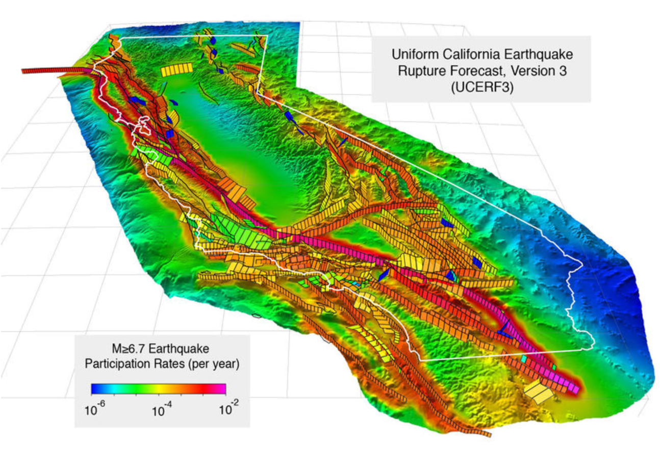
5. Improvement of Probabilistic Seismic Hazard Analysis (PSHA)
National Seismic Hazard Map (1990)
National Seismic Hazard Map (2008)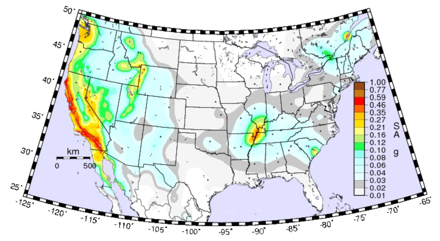
National Seismic Hazard Map, California and Nevada details (2008)
NGA (2008) Attenuation Relations used in National Seismic Hazard Maps
6. Development of simulation-based ground-motion prediction models (CyberShake)
CyberShake (2013) Hazard Model using CVM-H (made using simulations of shaking from thousands of earthquakes at hundreds of locations throughout Southern California)
Simulation of M7.8 Earthquake on the Southern San Andreas Fault (May take a minute or more to load; try clicking in the blank space to play the video)
Download this animation (Ctrl-click or option-click)
SCEC Community Velocity Models (CVMs)
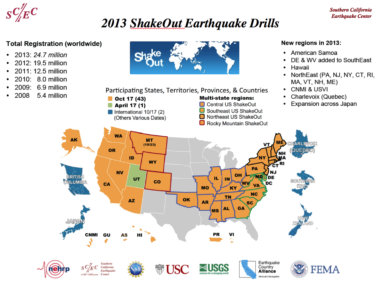
7. Scientific support of the ShakeOut Earthquake Preparedness Drills
Great Southern California ShakeOut Results (Nov. 13, 2008)
2013 Great ShakeOut Earthquake Drills, worldwide